
Imray Chart C30: Harwich to Hoek Van Holland and Dover Strait
Synopsis
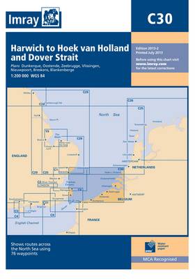
Plans included: Dunkerque (1:25,000) Nieuwpoort (1:30,000) Oostende (1:20,000) Blankenberge (1:10,000) Zeebrugge (1:35,000) Breskens (1:12,500) Vlissingen (1:20,000) This second 2013 edition of Imray's best-selling chart of the southern North Sea incorporates full details of the routeing measures around Hook of Holland and at North Hinder, which are due to be implemented on 1st August. The completed Greater Gabbard windfarms are shown, as are windfarm developments at Thorntonbank. Revised depths have been used off the coast of Suffolk and along the Dutch coast between Europoort and Walcheren. For this chart, Peter Cumberlidge has selected over 70 strategically placed waypoints and produced safe recommended routes across the southern North Sea and into the Thames Estuary as far as the Suffolk rivers. Presented as a clear blue overprint, these waypoints and routes are invaluable for negotiating the complex busy shipping lanes and provide users of chart C30 a convenient facility for passage planning.
Publisher information
- Publisher: Imray, Laurie, Norie & Wilson Ltd
- ISBN: 9781846236594
- Number of pages: 1
- Dimensions: 295 x 210 x 5 mm