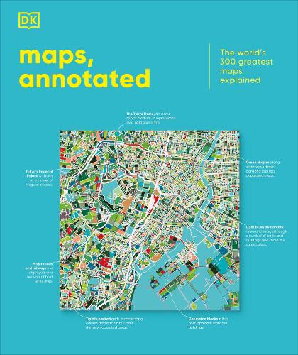
Maps, Annotated: The World's 300 Greatest Maps Explained
Synopsis
This glorious guided tour of cartographic history features more than 300 of the most famous and important maps of all time.
Immerse yourself in ancient Chinese star charts, decipher medieval Mappae Mundi, and marvel at intricate surveys of the ocean floor and the lunar surface. Discover how Polynesian navigators used sticks to chart their way across the Pacific, what a rhumb line is, and where dragons were once said to lurk.
Organized chronologically, the book includes the most celebrated examples of maps spanning more than 5,000 years, explaining everything from scales and compasses to meteorological symbols, and exploring techniques from engraving and printing to cartographic projection. Entries also place the maps in their wider cultural and historical context, providing a complete overview of the subject.
Combining stunning reproductions with precise annotation, visual analysis, and pull-out details, Maps, Annotated brings an expertly curated selection of the world’s most celebrated maps right into your home, telling the fascinating stories behind each one.
Publisher information
- Publisher: Dorling Kindersley Ltd
- ISBN: 9780241682845
- Number of pages: 480
- Dimensions: 286 x 242 x 36 mm
- Weight: 2408g
- Languages: English
Customer Reviews
You may also like...