Philip's World Flags Reference Map
Synopsis
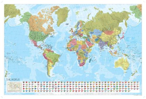
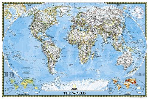
Fully updated for 2007-8, this wall map features a political map of the world, with individual countries picked out in bright, distinctive colours to aid identification. Town and city names are shown in clear type, with symbols highlighting national capitals. Major administrative areas (states and provinces) are marked in the largest countries: Canada, United States, Brazil, Russia, China and Australia. The scale at the Equator is 1:47 600 000.Also included on the wall map are 188 flags of the countries of the world, arranged in alphabetical order from Afghanistan to Zimbabwe, also fully updated for this edition.Philip's World Flags Reference Map is supplied laminated on one side and rolled into a clear plastic tube. It is ideal for mounting on a classroom wall or for use at home or in the office. The clarity of the map detail ensures that it is highly accessible for children and adults alike.Map projection: Miller Cylindrical.
Publisher information
- Publisher: Octopus Publishing Group
- ISBN: 9780540092352
- Dimensions: 780 x 44 x 45 mm
- Weight: 146g
Customer Reviews
You may also like...